
Weather Radar USA
Open it and you are already looking at an animated 2-hour radar loop; one tap switches to live GOES satellite imagery. National Weather Service watches and warnings sit on the same map, and tapping any point reads out the full alert.


- No sign-up
- Location optional
- Phones and tablets
- English
Radar
The map answers first,
the menu comes later
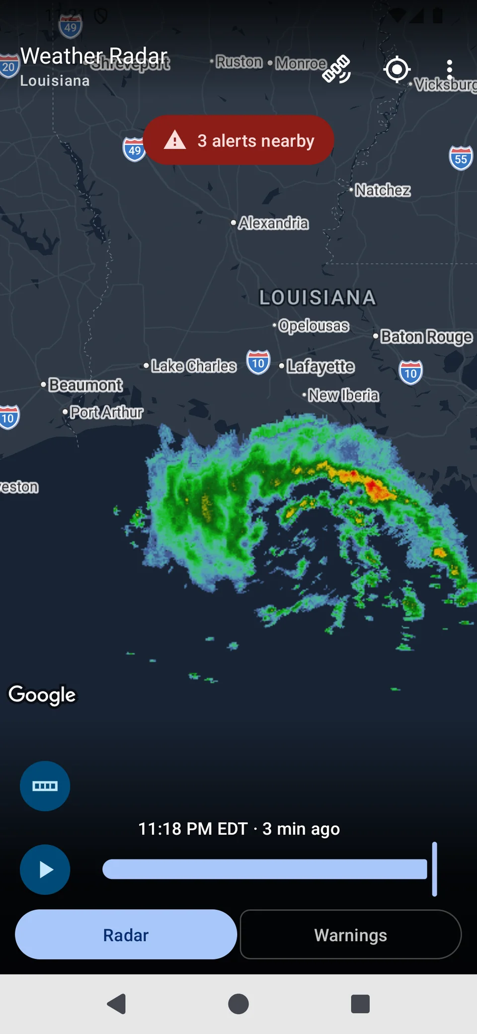
Most of the time the question is simple: is it raining on me, and is it about to? The app opens straight onto the radar map where you left it, and fills in the last two hours of echoes while the map is still settling. No splash screen, no sign-in.
- 12 frames at 10-minute steps from the NOAA MRMS reflectivity mosaic
- Playback keeps running while you pan and zoom
- A dark, desaturated base map so the storm is the only bright thing on screen
Warnings
Tap the map,
read the whole alert
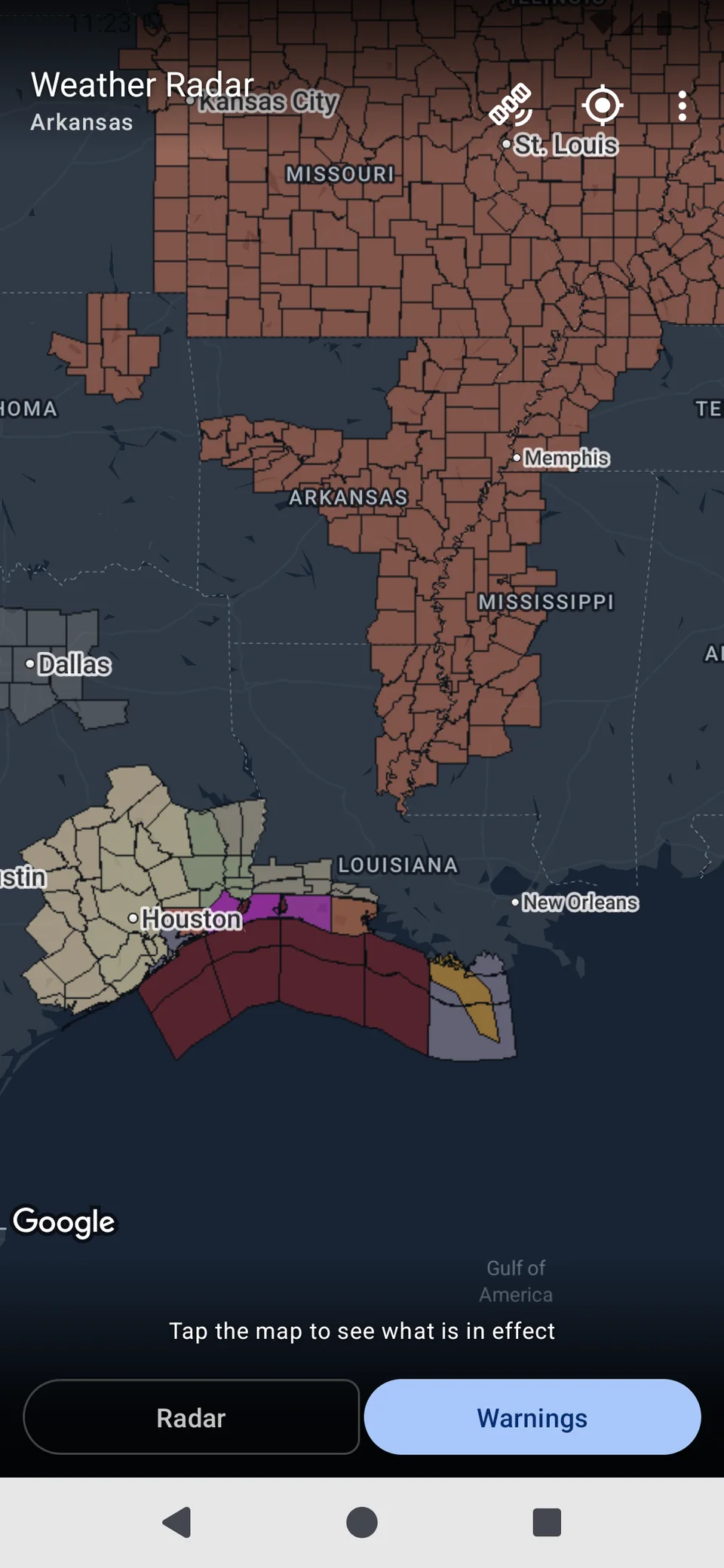
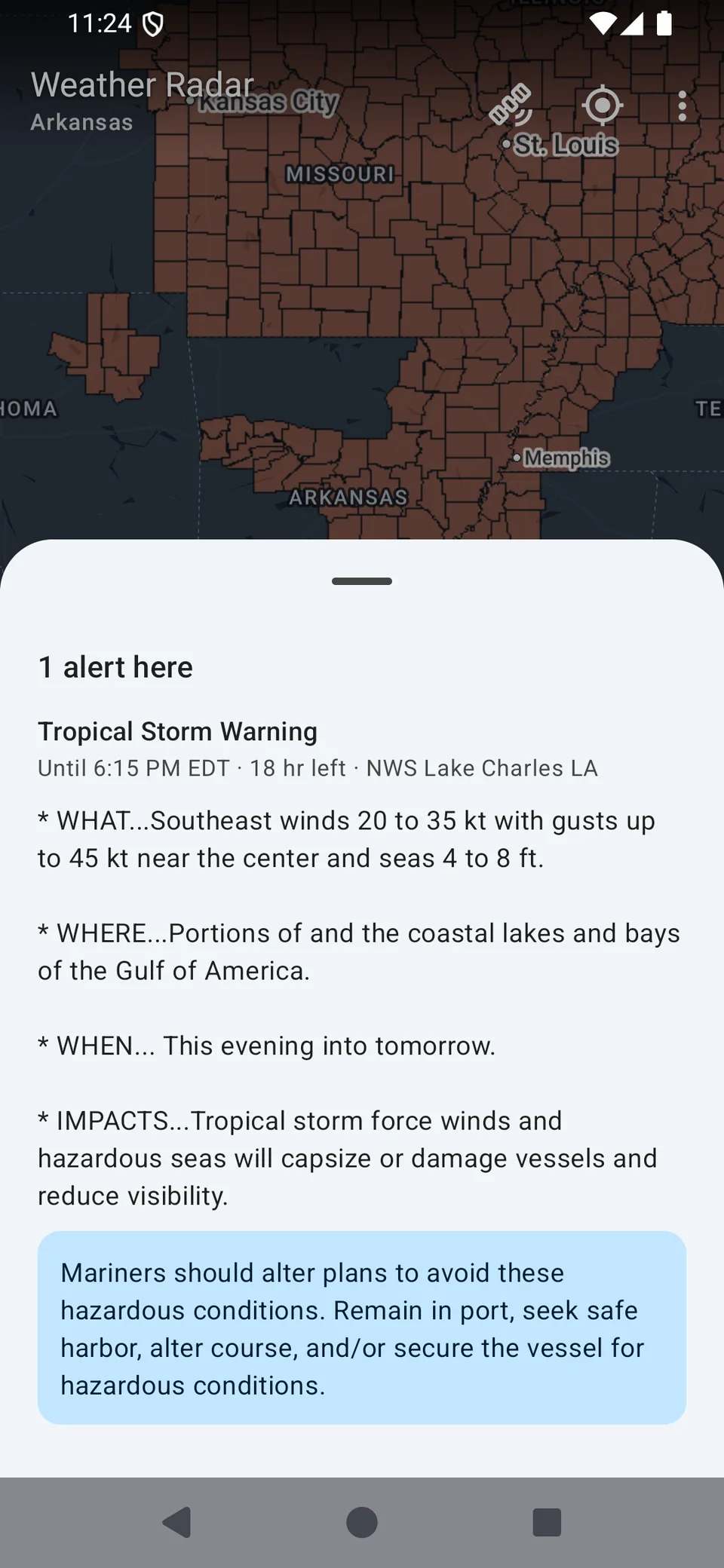
Warnings mode draws every active National Weather Service alert polygon — severe thunderstorm, tornado, flood, winter storm, heat, marine. Tap any point and the sheet shows the alert text as issued, not a summary. This is the part most radar apps leave out.
- WHAT / WHERE / WHEN / IMPACTS, then the precautionary instructions
- Overlapping alerts at the tapped point all appear in the sheet
- An alerts nearby chip on the radar side, red when one is a warning
Satellite
Live GOES imagery,
one tap away
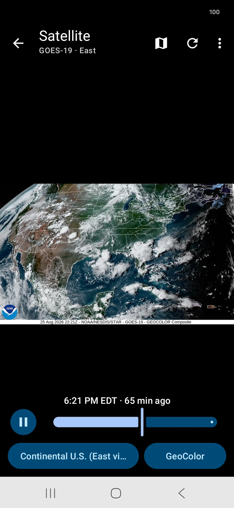
Where radar tells you what is falling right now, satellite tells you what is on the way — a frontal band, the spin of a tropical system, a line of storms still a state away.
- Current loops from GOES East and GOES West, as a 2-hour animation
- The image fills the entire screen, with controls floating on a soft scrim
- Set radar or satellite as the start screen
Zoom
Zoom in on any storm,
keep it moving
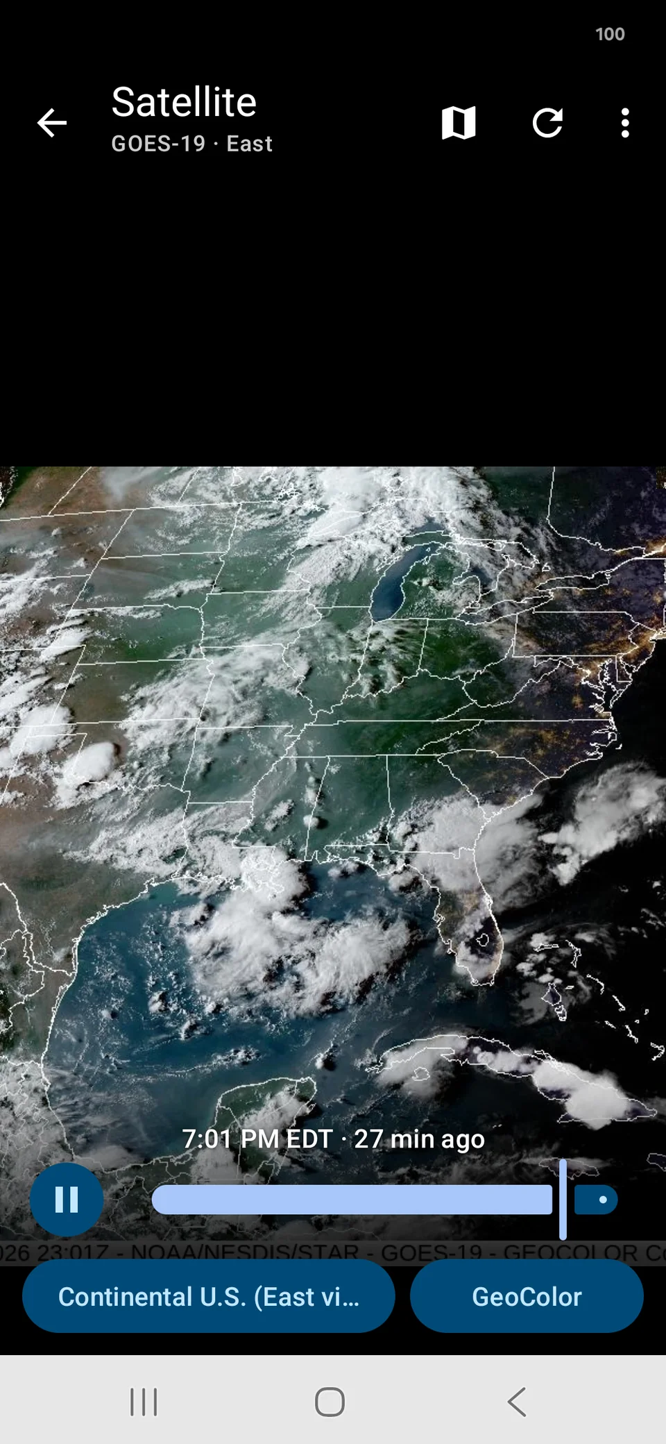
Zoom survives the loop. Frames keep advancing at whatever magnification you set — the whole point when you are watching a single cell rotate.
- Pinch freely, double tap to step in 2x, flick with real inertia
- Any edge or corner can be dragged to the center of the screen
- Pinch past the fit boundary and let go to snap back to the full view
Channels · Regions
9 channels,
22 regions
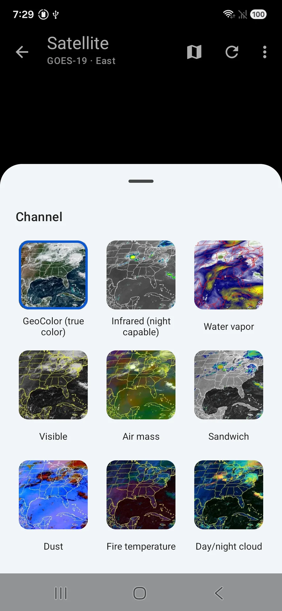
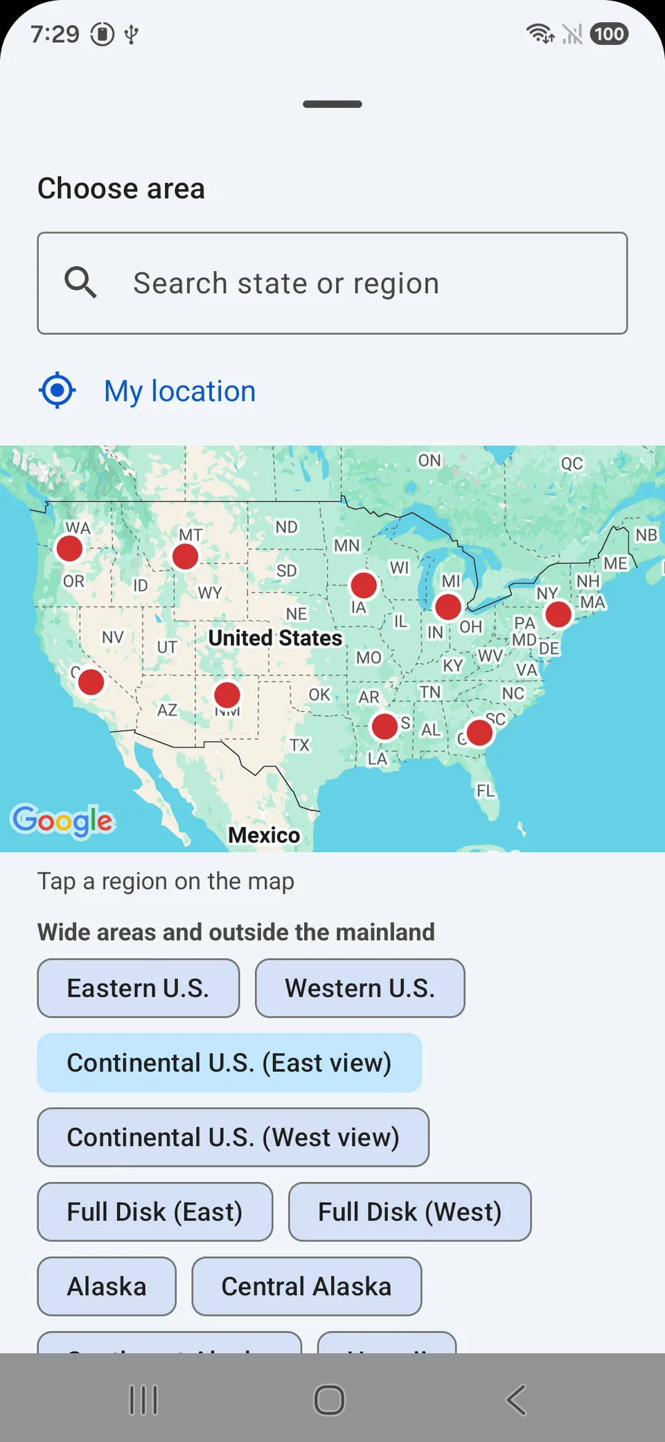
The channel picker is a grid of live thumbnails, so you pick by what the image looks like rather than by a spectral band. Coverage follows NOAA's own sectors, and the picker also takes a state name.
- GeoColor by default — true color by day, infrared with city lights at night
- Type Texas and it takes you to the sector that covers Texas
- A My location shortcut picks the nearest sector
See all features Channels · Regions · Radar details · Settings
9 imagery channels
- GeoColor — true-color by day, infrared blend with city lights at night
- Infrared — cloud-top temperature, around the clock, picks out the tallest storm tops
- Water vapor — mid-atmosphere moisture, where the jet stream and dry slots show
- Visible — plain reflected sunlight, sharpest daytime detail
- Air mass, Sandwich, Day/night cloud — composites that separate air masses and cloud types by color
- Dust and Fire temperature — blowing dust events and active fire hot spots
22 regions
- The continental US, nine mainland regions, Alaska, Hawaii, Puerto Rico and the Caribbean, and full-disk views from both satellites
- A tappable map, a list of wide-area views, and state-name search
- The region list comes from the server, so the app follows when NOAA reshuffles a sector
Radar details
- The timestamp under the map is the frame's own valid time, plus how long ago that was
- The color legend is one tap away and stays collapsed until you want it
- Radar and Warnings are exclusive modes so both stay instant when you change zoom
- Without location permission, the alerts chip uses the map center instead of asking again
Simple by design
- No account, no sign up — install it and you are looking at radar
- Start screen: radar, satellite, or whichever you saw last (default)
- Image quality setting for slower connections
- Phones and tablets, portrait and landscape — rotating keeps the spot you were looking at
- The map remembers where you left it, with that area's tiles already cached
Where the data comes from
- Radar — MRMS reflectivity mosaic (NOAA), 10-minute frames over the last 2 hours
- Watches and warnings — National Weather Service alerts, with the full issued text
- Satellite — GOES East and GOES West imagery (NOAA / NESDIS)
- Map base — Google Maps, on the radar screen only
- Requests go through a caching proxy, so the screen stays filled when an upstream server has a bad day
Privacy
- No sign-up, no login, no profile
- Location is optional — used to center the map and pick the nearest sector; nothing is uploaded or stored on a server
- Network access fetches public NOAA imagery and alerts, and serves ads
- Ads: the app is free and supported by Google AdMob banner and interstitial ads. The AdMob SDK sends advertising ID and impression data to Google. In the EEA, UK, and Switzerland a consent form appears on first launch, and the choice can be changed later from the overflow menu.
Not an official source
This app is not affiliated with NOAA or the National Weather Service. It is an independent viewer for imagery and alerts those agencies publish openly. For official warnings and safety guidance, follow your local NWS office and local emergency management.
See what is coming
No account — open it and the radar loop is already playing.
Free · Ad-supported · No in-app purchases · English · United States, including Alaska, Hawaii, Puerto Rico and the Caribbean