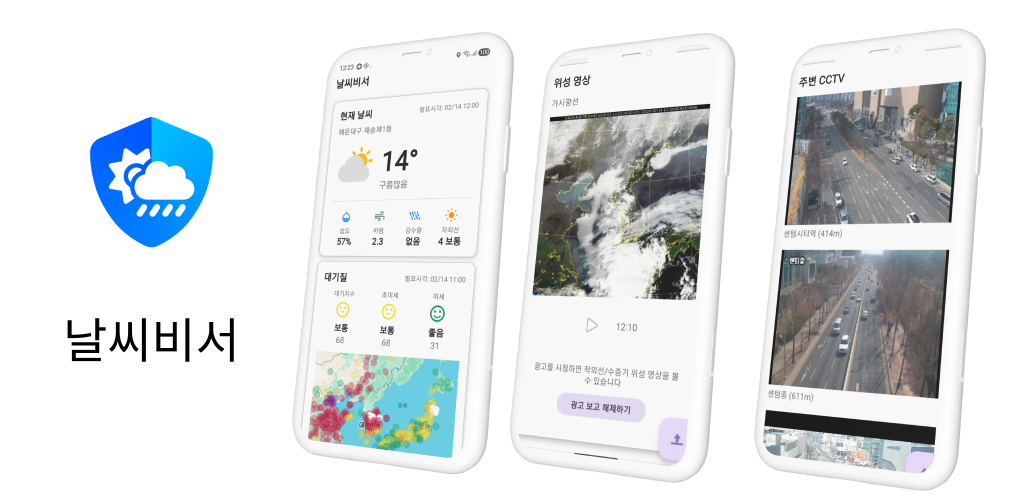
My Weather
From the Korea Meteorological Administration's neighborhood forecast to live traffic CCTVs — everything you need to check before stepping out, on one screen. Satellite, radar, air quality, pollen, and earthquakes too. No more bouncing between apps.
How many apps does it take to leave the house?
One app for the temperature, another for air quality, a maps app for traffic, and a news push for the latest earthquake — a 30-second check turns into 5 minutes, every day.
- The weather is fine, but the road might be jammed — and that means opening a different app to find out.
- You head out for a run without realizing the fine dust is at hazardous levels today.
- Your pollen allergy kicks in every spring, but you can never tell exactly when.
- You learn about a major earthquake hours later from a news push.
My Weather rolls KMA forecasts, UTIC road CCTVs, satellite & radar, air quality / pollen / UV, and earthquake / typhoon into a single screen.
Weather right where you are — Home screen
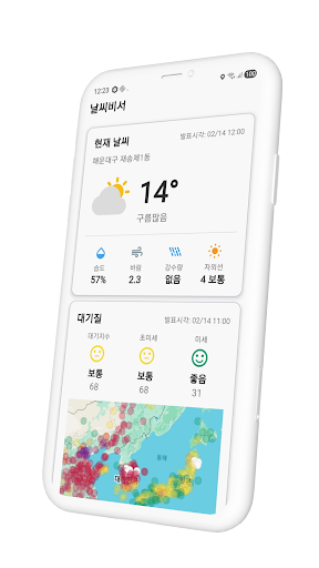
Open the app and the essentials for your current location or a saved favorite are laid out at a glance — KMA-grade current conditions up top, then hourly and daily forecasts, air quality, and the precipitation map below.
- Current weather — Temperature, humidity, wind, precipitation, UV index, feels-like
- Favorite locations — Register any number of neighborhoods and switch with a single chip tap
- Pull to refresh — Data older than 5 minutes auto-refreshes when the app returns from the background
Because My Weather is built on KMA's grid (3,500+ neighborhoods across Korea), forecasts vary precisely from one neighborhood to the next within the same city.
What to wear today — Hourly & weekly forecast
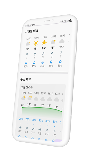
How warm at commute time, will it rain on the way home, do you need an umbrella this weekend — at a glance.
- Hourly forecast — Temperature, sky condition, wind direction, and rain chance, by the hour
- Weekly forecast — High/low temperature graph and daily rain chance & amount
- Ultra-short-term forecast — Finer-grained timing for the start and stop of rain within the next hour
Is the road clear? — Nearby CCTVs
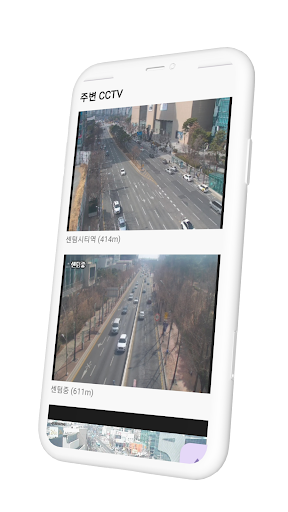
Check the road you're about to drive with live video. My Weather aggregates road CCTVs from UTIC (Korea's Urban Traffic Information Center) and similar sources, sorted by distance from your current location. Tap a card and the feed expands.
- HLS streaming — ExoPlayer-based smooth playback with pinch zoom and drag
- Distance label — Each card shows how many meters away the camera is
- Region filter — Filter by region (highways, Busan, Gyeonggi, Jeju, and more)
One map for everything — Rain overlay + CCTVs
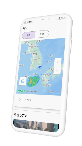
Toggle rain and snow overlays to see where precipitation is headed right now. On the same map you can show nearby CCTV markers, so you can answer "what does the rainy road over there actually look like?" in one tap.
- Rain / Snow toggle — Switch overlays with a tap
- Animation playback — Scrub through recent timesteps to see how the rain is moving
- Zoom & pan — Standard map SDK interactions
Where the clouds come from — Satellite imagery
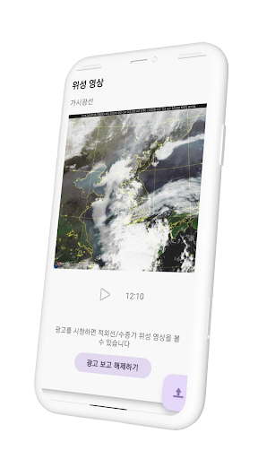
Watch the Chollian satellite's view of cloud movement over the Korean peninsula in time-lapse. Visible light is free; infrared and water vapor imagery unlocks with a single rewarded ad — no in-app purchases.
When will the rain stop? — Precipitation radar
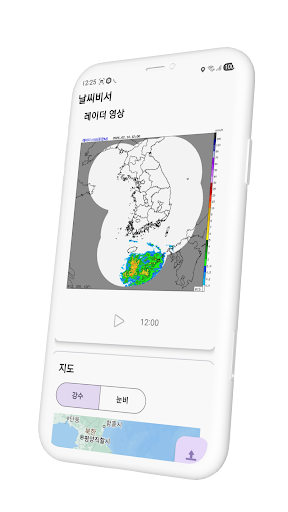
KMA's precipitation radar, played back in time order. Darker colors (yellow, red) mean heavier rain; lighter ones (green) mean light rain. This is the fastest way to answer "will this stop in an hour?"
Safe to go outside? — Air quality, pollen, UV
- Air quality (AQI) — PM10, PM2.5, and ultrafine particulates with a 5-level Good→Hazardous scale and a nationwide map
- Pollen (Health Weather Index) — Oak, pine, and weed pollen risk levels (concentrated Apr–Jun)
- UV index forecast — Hourly UV index with a 5-level Safe→Extreme scale
Especially helpful if you have allergies, asthma, or sensitive skin — or if you head out with kids or older family members.
If the ground shook — Earthquakes, typhoons, tsunamis
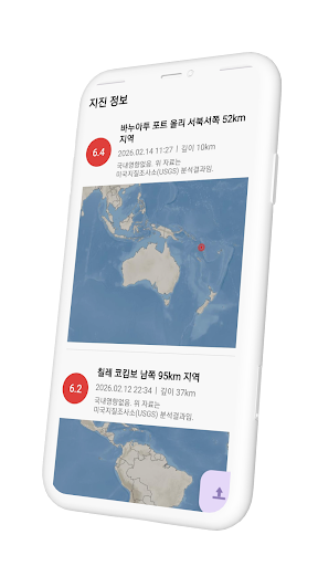
Recent earthquakes worldwide and in Korea are listed with magnitude, location, depth, and time, with the epicenter pinned on a map. Typhoon tracks and tsunami alerts surface on the same screen.
Home screen widgets (4×1 / 4×2)
Two widgets let you check the weather without even opening the app.
- 4×1 widget — Current temperature and condition with a small precipitation-radar thumbnail
- 4×2 widget — Precipitation radar map plus an hourly forecast strip
- Location picker — Use your current location or any registered favorite
- Background updates — Refreshed periodically via WorkManager, with cached data so something is always visible offline
Privacy — straight talk
- No account, no sign-in. Open the app and you're in.
- Location is used only for current-location weather and nearby CCTV search, processed on-device.
- Ads disclosure: My Weather is free and includes Google AdMob banner ads. Some content (infrared/water vapor satellite imagery, additional CCTVs) unlocks with a single rewarded ad. There are no in-app purchases.
App information
- Platform: Android
- Minimum requirement: Android 8.0 or later
- Data sources: KMA (neighborhood forecast, ultra-short-term forecast, precipitation radar, satellite imagery), UTIC (road CCTVs), and others
- Price: Free (banner ads + rewarded ads to unlock extra content)