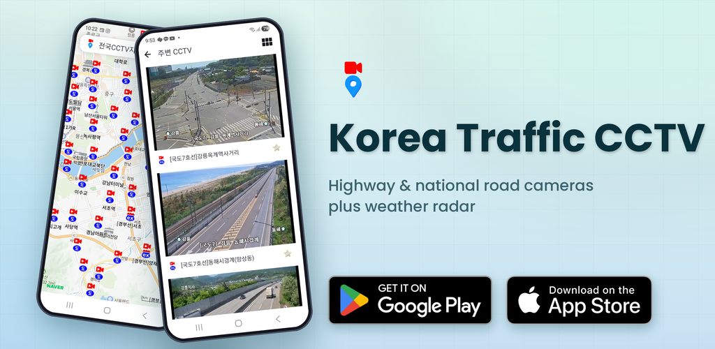
Korea Traffic CCTV
Watch live road cameras across Korea — expressways, national highways, and city streets — on a single map, with rain and snow radar layered on top.
Get it on Google Play Download on the App Store
When you need to know what the road looks like — right now
Long drives, holiday traffic, heavy rain or snow — a quick look at the actual road would make every trip easier. The catch is that the sources are scattered.
- Expressway cameras are run by the Korea Expressway Corporation, national highways by MOLIT's ITS, and city streets by each municipality.
- Every website has its own login, authentication, or plugin requirement.
- Weather radar is on yet another site at the Meteorological Agency.
- You just want to glance at a few cameras on your commute — but you keep having to dig them out one by one.
Korea Traffic CCTV puts it all in one app — a nationwide integrated map, live video with 5–10 minute delay, and rain & snow radar overlay.
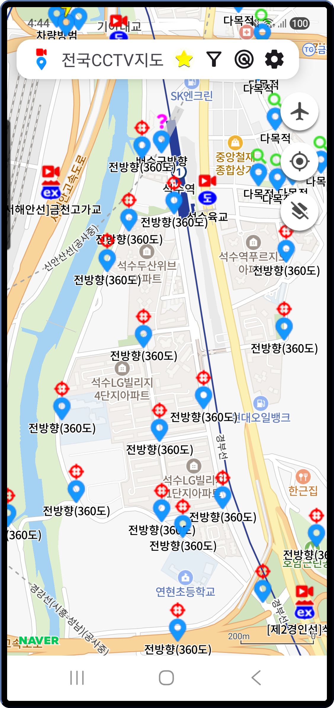
Every camera in Korea, on one map
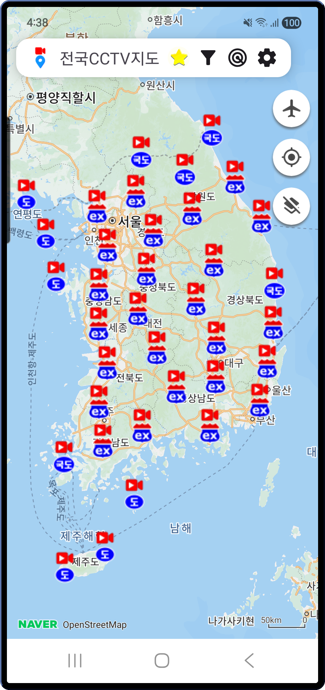
Cameras from the National Police UTIC, MOLIT's ITS, and the Seoul, Gyeonggi, Busan, Daegu, and Jeju open APIs are merged into one map.
- Expressway · National highway · Urban motorway · Regular road — each shown with its own color and icon
- Markers cluster and thin automatically with the zoom level, so the map never feels cluttered.
- One-tap switch between satellite and standard map
- The app remembers your last camera position and zoom, so it reopens right where you left off.
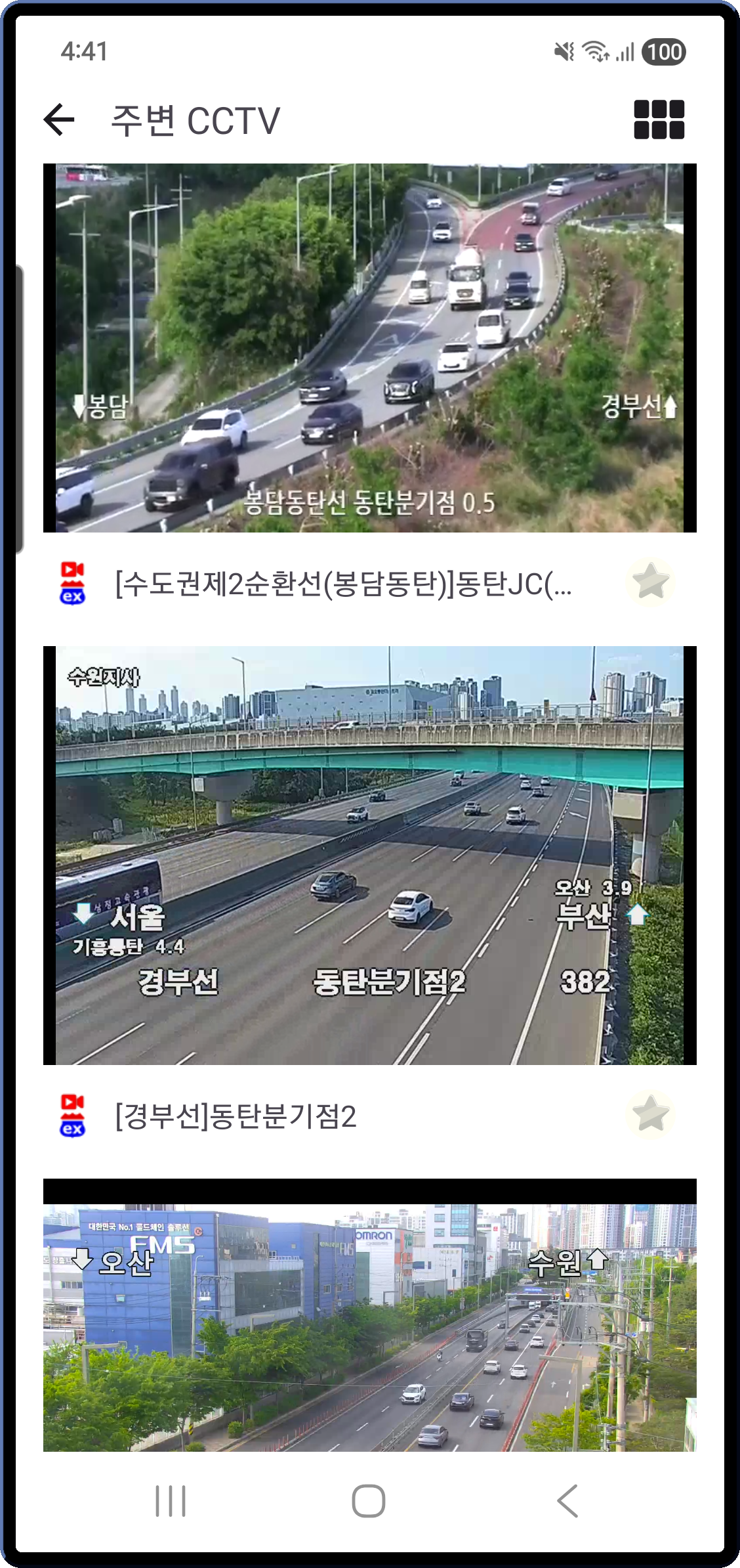
Tap a marker — live video right there
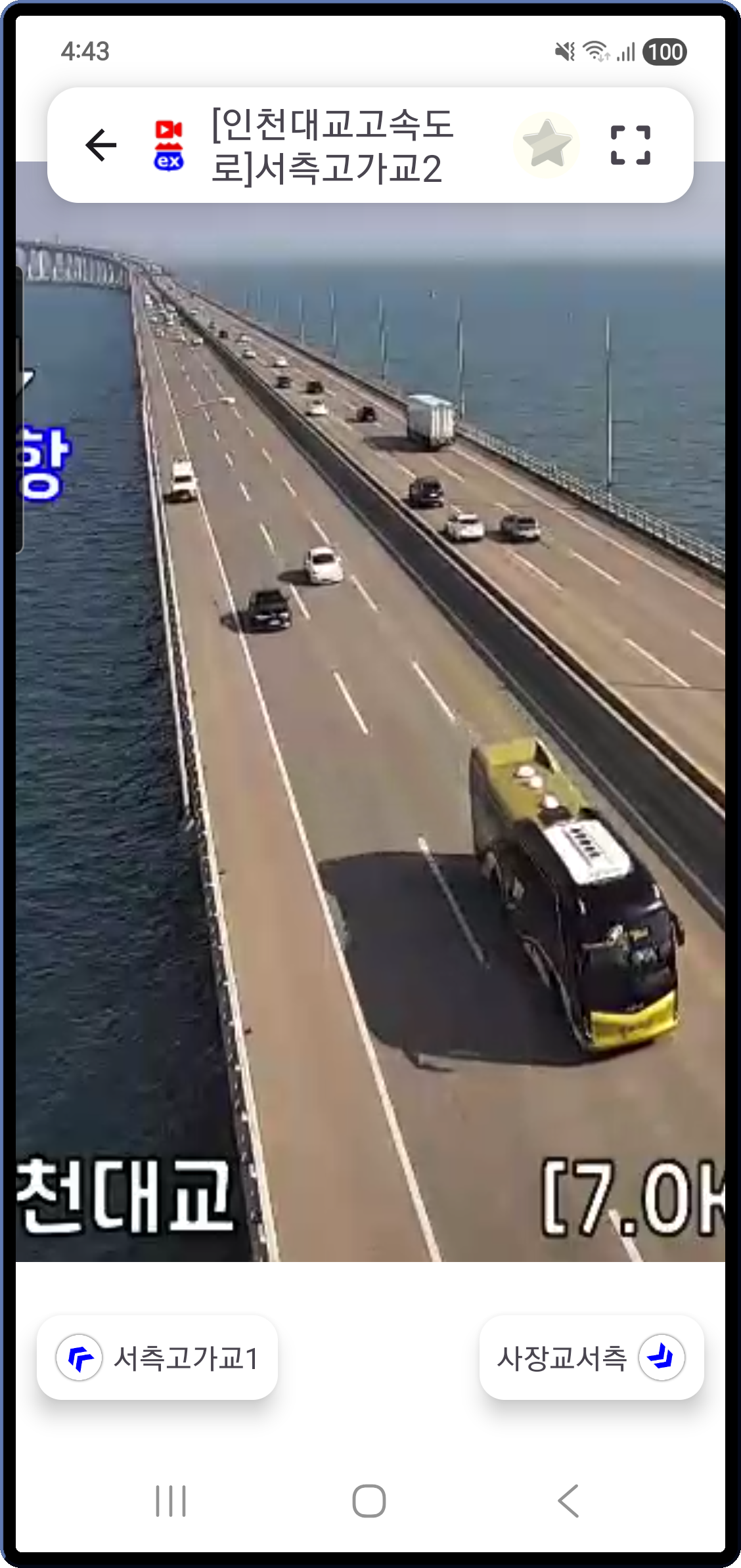
Tap any marker and live video starts instantly. No external browser, no separate player — it streams inside the app.
- HLS streams play through ExoPlayer — 5–10 minutes behind real time
- Pinch zoom, drag, double-tap zoom — control the frame freely
- Rotate the phone to landscape and it goes full-screen automatically, back to portrait reverts
- Left / right arrows at the bottom jump to the next camera on the same road — coordinate-based sorting keeps the route in order
Watch several nearby cameras at once
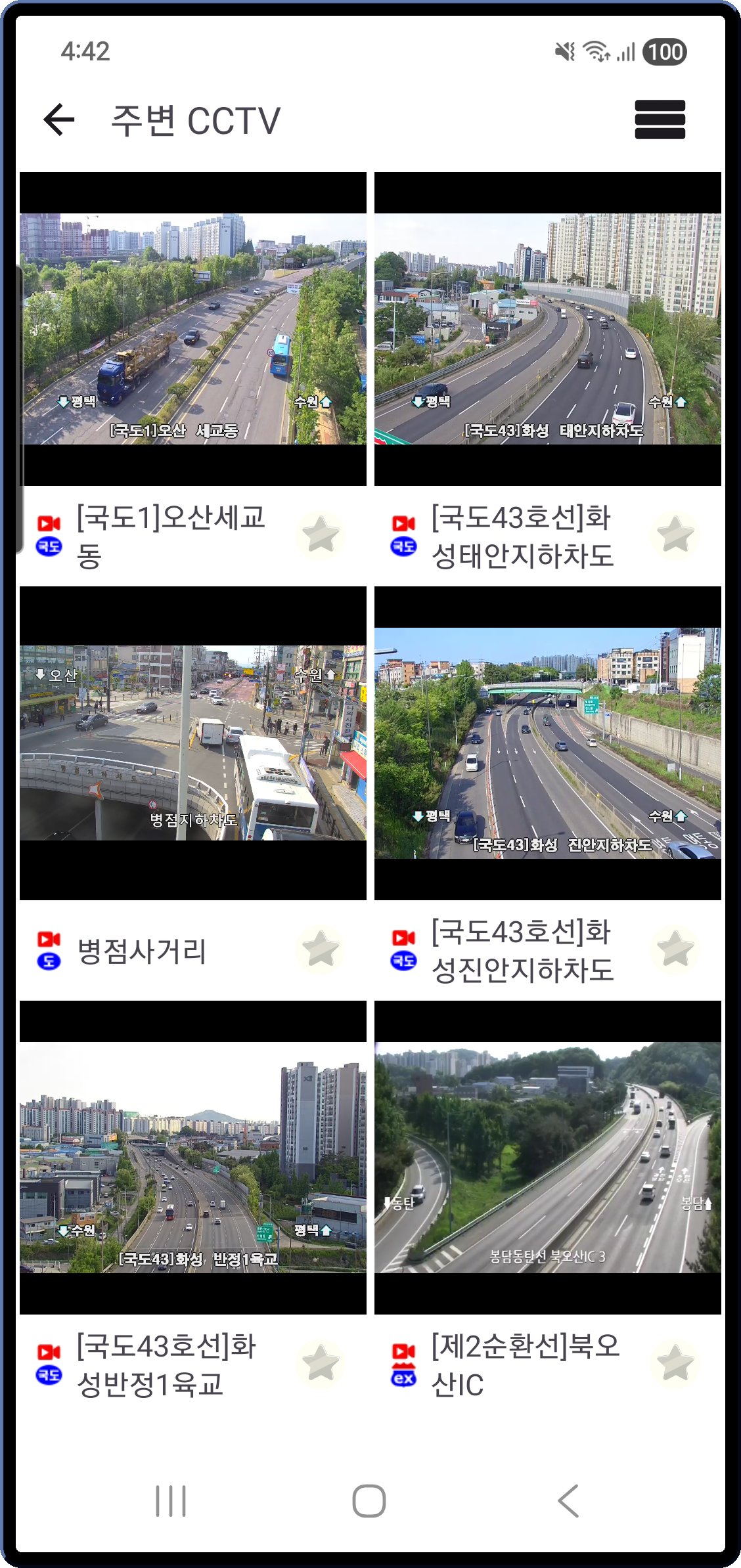
The search button at the bottom of the map starts streaming the cameras nearest the current map center, all at the same time.
- 6-split grid for multi-monitor style watching
- The grid itself supports pinch zoom and pan so you can resize cells freely
- Tap any cell to expand that camera into a single full-screen player
A list view is also available — large videos stacked one per row, handy for scrolling through your commute route.
Filter by road type and road name
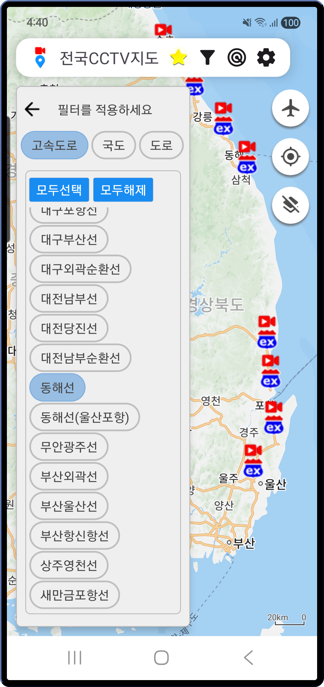
When there are too many markers, narrow them down with the two-level filter.
- Step 1 — Road type: expressway / national highway / regular road
- Step 2 — Road name: pick specific routes like Gyeongbu, Donghae, Seohaean, and so on
- Select all / Clear all for quick reset
Set it to "Gyeongbu Expressway only", for example, and the map shows just the cameras along that one route — easy to follow the flow.
Rain & snow radar overlay
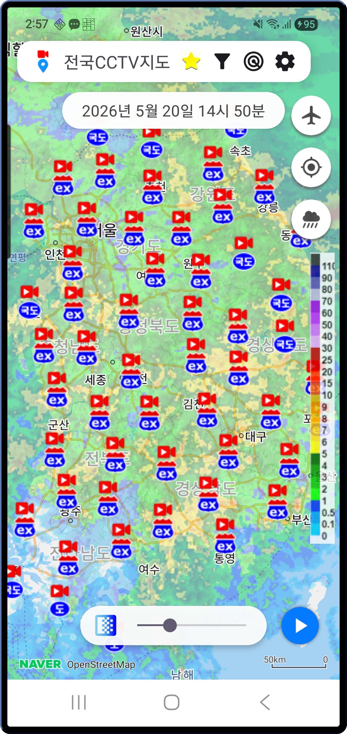
The radar button on the right side of the map toggles rain or snow overlays on.
- Time-series radar images from the Korea Meteorological Administration play as a time-lapsed animation over the map.
- An opacity slider lets you see roads and precipitation together at any blend.
- Switch between rain and snow at a tap — get a quick read on storm zones.
Because you can see where the rain cloud is moving on top of the road cameras, it's easy to make a reroute call right before you leave.
Favorites — pin the cameras you always watch
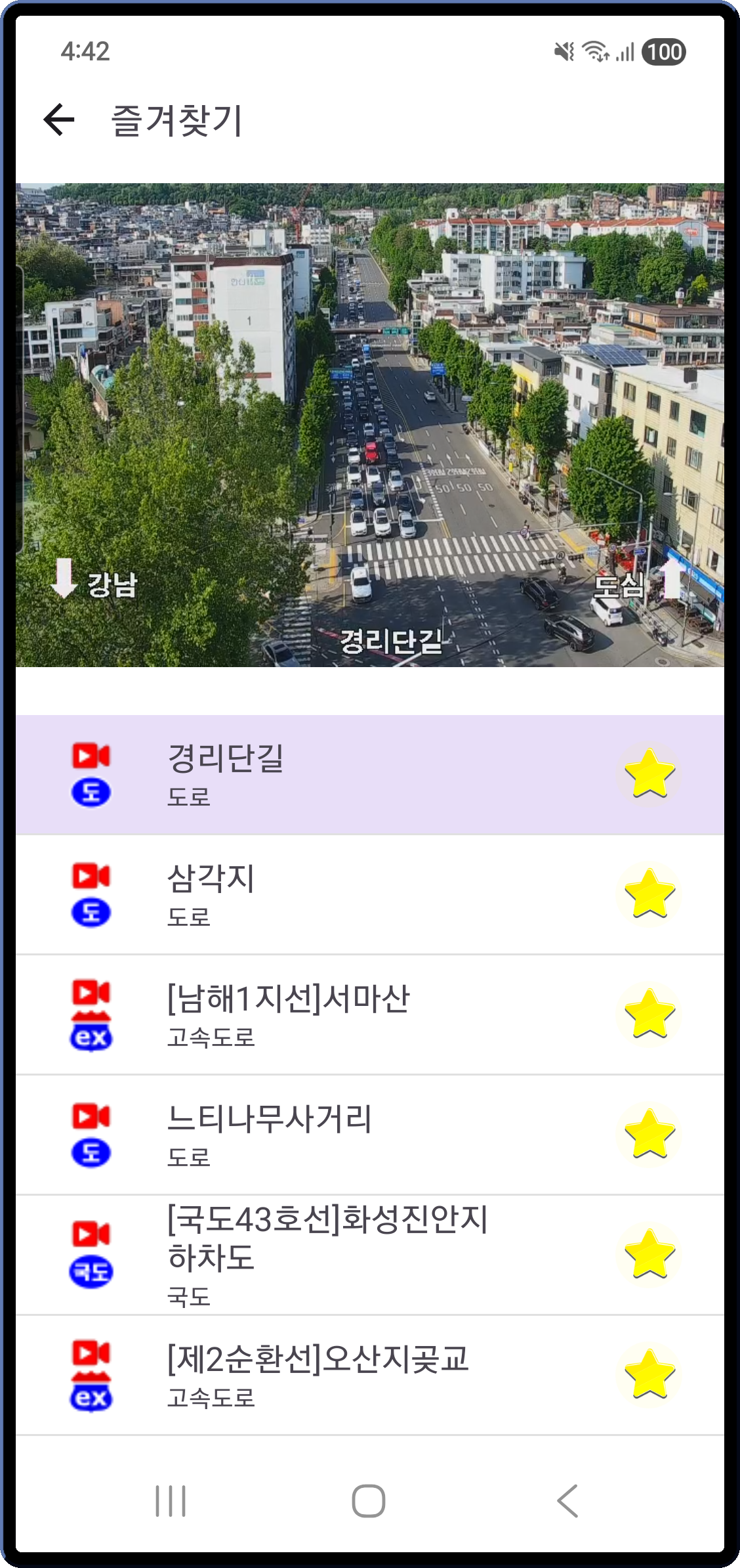
If there are cameras you check every day on your commute, tap the star once to save them.
- Tap an item in Favorites and it plays live in the slot at the top immediately.
- Swipe left or right to cycle through your favorites.
- If the upstream data refreshes and a camera ID changes, coordinate-based matching reconnects the camera at the same location automatically.
Beyond traffic — fixed-camera info too
Fixed cameras without traffic video appear on the same map — school zones, neighborhood safety, traffic and parking enforcement, school grounds, disaster monitoring, railroads, and more, each marked with a purpose-specific icon.
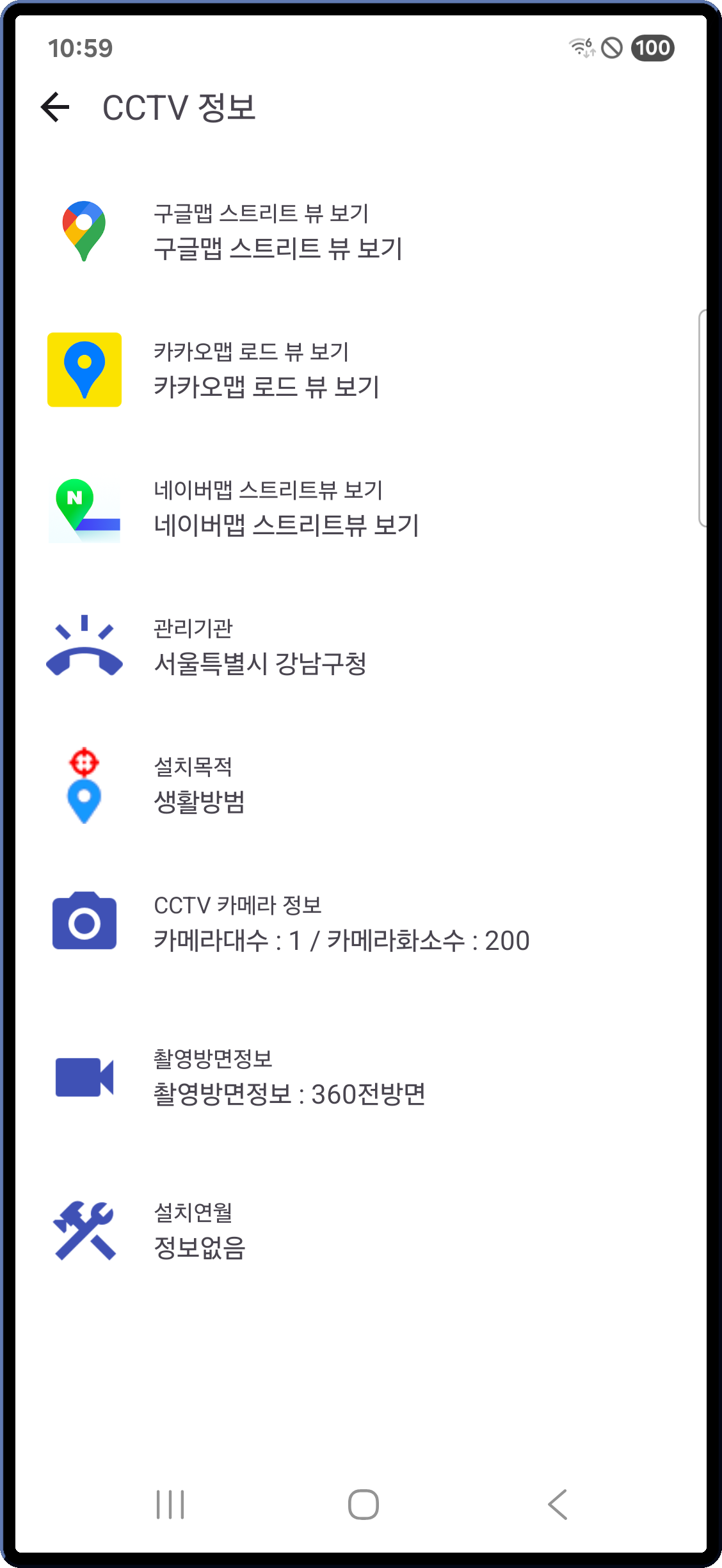
Tap a marker and the camera's metadata opens up on one screen.
- Operating agency · phone number (tap to dial)
- Purpose · number of cameras · resolution · viewing direction · installation date
- One-tap links to Google Street View, Kakao Road View, and Naver Street View
Useful for checking camera locations around your home, or for quickly identifying the responsible agency after an incident.
Dark mode & dark map
- System-aware theme: Light / Dark / System
- The map itself can be set to light or dark independently — easier on the eyes for late-night checks before driving
What makes it different
- Versus MOLIT's ITS app — ITS focuses on expressways and national highways. Korea Traffic CCTV merges UTIC + ITS + 5 municipal sources + fixed cameras into one map.
- Versus individual municipal CCTV sites — Each site has its own login and auth, and city-street cameras are scattered. The app's own proxy server (
campx.boolint.com) plus Cloudflare caching handle the authentication invisibly. - Versus opening the weather radar separately — Rain and snow distribution overlays on the same screen as the road video, so reroute decisions happen in one glance.
- Versus generic video viewers — Adjacent-camera left/right navigation and 6-split simultaneous playback let you watch along a road like a route.
Privacy
- No account, no sign-in. Open the app and you're in.
- Location permission is used only for the "My location" button and the nearby-camera search, and is processed locally on the device.
- Video is streamed via public open APIs and the app's own proxy — nothing is stored on your device.
- Ads disclosure: the app is free to use and includes Google AdMob ads. The AdMob SDK sends your advertising ID and impression/click events to Google.
Safety
For safety, please do not use this app while driving. Use it before departure, while parked, or have a passenger operate it.
App information
- Platform: Android / iOS
- Minimum requirement: Android 8.0 or later
- Languages: English / Korean (auto-detected from device settings)
- Dark mode supported
- Price: Free (ad-supported, no in-app purchases)
- Data sources: National Police UTIC, MOLIT ITS, Seoul / Gyeonggi / Busan / Daegu / Jeju open APIs, Korea Meteorological Administration